Garmin Montana 650t and 550T

Garmin Montana 650t Waterproof Hiking GPS with TOPO U.S. 100K and 5 Megapixel Camera
| Price: | $599.99 & FREE Shipping |
- 4-inch LCD display
- 5 MP autofocus digital camera with automatic geo-tagging; Worldwide built-in baesmap with shaded relief, preloaded U.S. Topo
- Bright sunlight readable touchscreen color display
- 3-axis compass and barometric altimeter
- High-sensitivity, WAAS-enabled GPS receiver
Special Offers and Product Promotions
Frequently Bought Together
Product Information
| Item Weight | 10.2 ounces |
| Product Dimensions | 5.7 x 1.4 x 2.9 inches |
| Item model number | 010-00924-02 |
| Batteries: | 3 AA batteries required. (included) |
| Display Size | 4 inches |
| Display Resolution | 272 x 480 |
| Warranty | 1 year limited |
| Memory Card Slot | Flash |
| Battery Life | 16 hours |
| ASIN | B0050SNCPC |
| Customer Reviews | |
| Best Sellers Rank | #7,312 in Electronics (See top 100)
|
| Shipping Weight | 2 pounds (View shipping rates and policies) |
| Shipping | Currently, item can be shipped only within the U.S. |
| Date First Available | May 18, 2011 |
Compare to Similar Handheld GPS Units
This item: Garmin Montana 650t Waterproof Hiking GPS with TOPO U.S. 100K and 5 Megapixel Camera | Garmin Oregon 550T 3-Inch Handheld GPS Navigator with 3.2MP Digital Camera (U.S. … | Garmin GPSMAP 62St Handheld GPS Navigator | Garmin Dakota 20 Waterproof Hiking GPS | |
| Customer Rating |
| |||
| Price | $599.99 | $279.99 | $292.99 | $184.85 |
| Shipping | Free Shipping | FREE Shipping | FREE Shipping | $4.99 |
| Sold By | Less Is Always More LLC | Sandy and Son | PrimeDeal | MagsTag |
| Display Size The display size is how large the screen of your computer is, measured from one corner to the opposite diagonal corner. Larger screens allow you more visual space for your programs and often have high resolutions, but require more power from your computer. | 4 inches | 3 inches | 2.6 inches | 2.6 inches |
| Bluetooth | N | N | N | N |
| Battery Life | 16 Hours | 16 Hours | 20 Hours | 20 Hours |
| Add to Cart | Add to Cart | Add to Cart | Add to Cart |


Product Description
Amazon.com Product Description
High-resolution, crystal clear enhanced colors on a vast 4-inch sunlight-readable touchscreen. |

 |  |
Touchscreen dual orientation display |
Includes TOPO U.S. 100K maps and supports multiple mapping options like BirdsEye Satalitte Imagery and it has a 5 megapixel camera. |


Take Geotagged Pictures
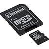
Capture locations and memories with Montana 650t’s 5 megapixel digital camera. Each photo is geotagged automatically with the location of where it was taken, allowing you to navigate back to that exact spot in the future. Snap and view pictures in landscape or portrait orientation. To keep track of your photos and show their location on a map, simply connect Montana 650t via USB and use Garmin’s free BaseCamp™ software. For more storage, insert a microSD™ card; you can even view pictures from other devices on microSD with Montana's picture viewer.
Go Anywhere
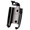
With an array of compatible mounts, Montana 650t is designed for use on ATV’s, in boats, as a handheld or in your car as a personal navigator. Use the auto mount with City Navigator maps for spoken, turn-by-turn driving directions, or the rugged mount for your motorcycle or ATV. Wherever you think you might take Montana, it has the mapping and mounts to get you there.
Go Everywhere
Adding more maps is easy with Garmin's wide array of detailed topographic, marine and road maps. With its microSD™ card slot, Montana 650t lets you load TOPO U.S. 24K maps and hit the trail, plug in BlueChart® g2 preloaded cards for a great day on the water or City Navigator map data for turn-by-turn routing on roads (see maps tab for compatible maps). Montana 650t also supports BirdsEye™ Satellite Imagery (subscription required), that lets you download satellite images to your device and integrate them with your maps. In addition, Montana is compatible with Custom Maps, free software that transforms paper and electronic maps into downloadable maps for your device.
Share Wirelessly
With Montana 650t you can share your waypoints, tracks, routes and geocaches wirelessly with other compatible Garmin GPS users. So now your friends also can enjoy your favorite hike or cache – simply press “send” to transfer your information to similar units, and let the games begin.
Keep Your Fix
With its high-sensitivity, WAAS-enabled GPS receiver and HotFix® satellite prediction, Montana 650t locates your position quickly and precisely and maintains its GPS location even in heavy cover and deep canyons. The advantage is clear — whether you’re in deep woods or just near tall buildings and trees, you can count on Montana 650t to help you find your way when you need it the most.
Navigate with Ease
Montana 650t has a built-in 3-axis tilt-compensated electronic compass, which shows your heading even when you’re standing still, without holding it level. Its barometric altimeter tracks changes in pressure to pinpoint your precise altitude, and you even can use it to plot barometric pressure over time, which can help you keep an eye on changing weather conditions.
Double Your Power
Montana 650t features a one-of-a-kind dual battery system. You’ll have the option of using the rechargeable lithium-ion pack or traditional AA alkaline batteries – whichever suits your needs better.
Find Fun
Montana 650t supports geocaching GPX files for downloading geocaches and details straight to your unit. Visit OpenCaching.com to start your geocaching adventure. By going paperless, you're not only helping the environment but also improving efficiency. Montana 650t stores and displays key information, including location, terrain, difficulty, hints and descriptions, which means no more manually entering coordinates and paper print outs! Simply upload the GPX file to your unit and start hunting for caches.
What's in the Box
Montana 650t, Lithium-ion battery pack, USB cable, AC charger, Quick start manuals, Owner's manual on disk
Product Description
Garmin Oregon 550 Waterproof Hiking GPS (Discontinued by Manufacturer)
- Capture locations and memories with a 3.2 megapixel autofocus digital camera with 4x digital zoom
- Tough, 3-inch diagonal, sunlight-readable, color touchscreen display
- Built-in 3-axis tilt-compensated electronic compass shows your heading even when you're standing still, without holding it level
- Barometric altimeter tracks changes in pressure to pinpoint your precise altitude, and can help you keep an eye on changing weather conditions
- Comes preloaded with a worldwide built-in basemap with shaded relief; add more detailed maps with a MapSource microSD card
Special Offers and Product Promotions
Frequently Bought Together
Product Information
| Item Weight | 6.9 ounces |
| Product Dimensions | 2.3 x 1.5 x 4.5 inches |
| Item model number | 010-00697-10 |
| Display Size | 3 inches |
| Warranty | 1 year |
| Battery Life | 16 hours |
| ASIN | B0029LL5IY |
| Customer Reviews | |
| Best Sellers Rank | #15,641 in Electronics (See top 100) |
| Shipping Weight | 1.6 pounds (View shipping rates and policies) |
| Shipping | Currently, item can be shipped only within the U.S. |
| Date First Available | July 1, 2009 |


Product Description
Amazon.com
 Oregon 550 combines rugged outdoor touchscreen navigation with a 3.2 megapixel digital camera. Click to enlarge. |
 3.2 megapixel autofocus digital camera with 4x digital zoom. Click to enlarge. |
 Preloaded with a worldwide built-in basemap with shaded relief. Click to enlarge. |
 3-inch diagonal, sunlight-readable, color touchscreen display. Click to enlarge. |
Take Pictures and Save Locations
Capture locations and memories with Oregon 550's 3.2 megapixel autofocus digital camera with 4x digital zoom. Each photo is automatically geotagged with the location of where it was taken, allowing you to navigate back to that exact spot in the future. Snap and view pictures in landscape or portrait orientation. With 850 MB of internal memory, you'll never miss a photo opportunity. To store online, simply connect Oregon 550 via USB and log into my.Garmin.com to upload and store your photos at Picasa, a popular online photo sharing community for friends and families around the world. For more storage, insert a microSD card; you can even view pictures from other devices on microSD with Oregon's picture viewer.
Touch and Go
Oregon 550 makes rugged navigation effortless with a tough, 3-inch diagonal, sunlight-readable, color touchscreen display. The interface is easy to use, so you'll spend more time enjoying the outdoors and less time searching for information. Both durable and waterproof, Oregon 550 is built to withstand the elements. Bumps, dust, dirt, humidity and water are no match for this rugged navigator.
Get Your Bearings
Oregon 550 has a built-in 3-axis tilt-compensated electronic compass, which shows your heading even when you're standing still, without holding it level. Its barometric altimeter tracks changes in pressure to pinpoint your precise altitude, and you can even use it to plot barometric pressure over time, which can help you keep an eye on changing weather conditions. And with its high-sensitivity, WAAS-enabled GPS receiver and HotFix satellite prediction, Oregon 550 locates your position quickly and precisely and maintains its GPS location even in heavy cover and deep canyons.
Add Maps
Oregon 550 comes preloaded with a worldwide built-in basemap with shaded relief. Adding even more detail is easy: just insert a MapSource microSD card preloaded with detailed maps. Oregon can accept a variety of maps for any navigational need. Add detailed street maps to get turn-by-turn directions to your destination. Add select topographic maps to take advantage of Oregon's 3-D maps and elevation detail. Or add BlueChart g2 maps, which provide everything you need for a great day on the water, including depth contours, navaids and harbors.
Find Fun
Go paperless with Oregon 550 by quickly downloading information from Geocaching.com for up to 5000 caches, such as location, terrain, difficulty, hints and description. No more manually entering coordinates and paper print outs. Slim and lightweight, Oregon is the perfect companion for all your outdoor pursuits.
Share Wirelessly
With Oregon 550 you can share your waypoints, tracks, routes and geocaches wirelessly other Oregon and Colorado users. Now you can send your favorite route to a friend to enjoy or the location of a cache to find. Sharing data is easy. Just touch "send" to transfer your information to similar devices.
What's in the Box
Oregon 550, AA battery charger, 2 AA NiMH batteries, carabiner clip, USB cable, owner's manual on disk, and quick start manual
